


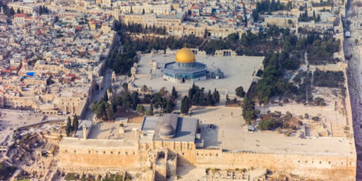
What it doesn’t include, however, is the State of Israel. The book’s colorful map of the Middle East removed any mention of the Jewish homeland, instead labeling the entire country as “Palestine.”
This month, Canada’s biggest bookseller Chapters Indigo pulled copies of the children’s book from its shelves after Daniel Koren, Canadian director of Hasbara Fellowships, spotted it and contacted Indigo directly.
The response from Indigo Chapters was a commendable one: the business acknowledged that the sale of the book had breached its own policy and thus rectified the problem.
Yet, this is not the first time that Israel has been expunged from maps of the Middle East.
It is a problem that has cropped up repeatedly, and while sometimes these instances are genuine mistakes, on other occasions, they represent an insidious attempt to undermine the legitimacy of the State of Israel.
Maps are a historical record and, therefore, the removal of Israel is a denial of reality — that of Jewish people living in their ancient homeland.
In May, a member of the New York State Assembly sparked condemnation, including from her own colleagues, when she shared an image that labeled the entirety of the Jewish state as “Palestine.”
The timing of Democratic Phara Souffrant Forrest’s tweet was particularly relevant: it came in the midst of the 11-day Hamas-initiated conflict against Israel. The US-designated terrorist organization was founded with the primary goal of obliterating the Jewish state.
As Forrest’s fellow assemblyman Daniel Rosenthal observed at the time: “Just like Hamas, my Assembly colleague wants to wipe Israel off the map.”
It seems, however, that Forrest actually took the misleading map from another source; namely, Vogue Arabia.
The so-called “Fashion Bible” had posted the exact same image of a flower-festooned Israel on its Instagram page and website, alongside a caption that described the Israeli-Palestinian conflict as a “hot-button” issue. It claimed the illustration was created by a Turkey-based artist in response to “Palestine not being included in Google Maps.”
However, Google had already debunked the claim that “Palestine” was deliberately wiped off maps of the region, explaining that there was no general consensus on where a potential Palestinian state’s borders would be, and pointed out that it had marked the areas of the West Bank and Gaza with dashed lines.
Despite outrage from social media users, who accused the publication of attempting to undermine the Jewish state’s legitimacy, the image remains live on its Instagram account today.